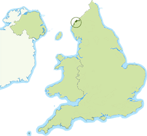
Solway Coast National Landscape
Stretching along the Cumbrian shore of the Solway Firth, this is a low, open, and windswept National Landscape with wide views across to the hills of Dumfries and Galloway.
The Solway Firth is one of the largest and most important inter-tidal habitats in Britain, with a huge intertidal range creating a dynamic landscape and seascape. Silting along the estuary has left extensive marine deposits and the open foreshore strip now consists either of marine terrace with low, scrub-covered sandstone cliffs or undulating dunes. The falling tides expose wide sand stretches, intertidal mudflats and, higher upstream, saltmarsh and lowland peat bogs, in a landscape with a sense of remoteness that is the essence of its value and character.
With varied habitats and rich feeding grounds, the estuary is of outstanding wildlife importance. An overwintering ground for huge numbers of wildfowl, the Upper Solway’s flats and marshes are a Ramsar site and seals, dolphins and porpoises have been sighted offshore. The South Solway Mosses National Nature Reserve is part of the largest relatively undamaged area of lowland raised mire in the country. The area has a rich historical and cultural heritage associated with its position on the Scottish border.
This is a traditional agricultural area remote from large towns. The National Landscape boundary skirts Silloth, the largest settlement and stops short of the fishing town of Maryport. Inshore fishing includes shrimping and local farming is mainly dairy, beef and sheep, with a longstanding tradition of common grazing on the marshes. Small, hedged fields are still a dominant feature in the landscape. Tourism is an important, though relatively undeveloped, supplement to the local economy, concentrated in caravan sites at the small resorts of Silloth and Allonby. A number of archaeological sites include defences built by the Romans and the Frontiers of the Roman Empire World Heritage Site stretches all the way along the coastline.
The National Landscape is also a popular day trip destination for visitors from Carlisle, the West Cumbrian coastal towns and Tyneside, and the shore road bears heavy peak season traffic. The Hadrian’s Cycleway passes through, and the King Charles III England Coast path also runs right through the National Landscape, linking up with the rest of the country. The Hadrian’s Wall Path National Trail follows the line of Hadrian’s Wall through the north of the National Landscape.